⚡ Why This Blog Matters
Trying to figure out where a random photo was taken can feel like detective work—but GeoSpy AI uses AI to identify photo locations instantly, no map skills needed.
🧠 What You’ll Learn Here
Learn how GeoSpy AI analyzes visual landmarks and metadata to suggest possible locations, offers side-by-side map views, lets you refine results, and supports exporting findings for travel stories or research.
🎯 Who Should Read This
Perfect for photographers, travel bloggers, journalists, and researchers who want to uncover location context quickly and accurately—without manual sleuthing.
Every photo holds more than what meets the eye. Beyond the subject, lighting, and composition, there are subtle hints—like the style of buildings, the type of trees, even the way the sun falls on a street. What if you could use those details to guess exactly where the picture was taken?
GeoSpy AI does just that. It’s an image-location recognition tool powered by artificial intelligence. By analyzing the background and physical elements in a photo, it can suggest where that image might have been captured, often with surprising accuracy.
For travelers, researchers, educators, or even the casually curious, this technology opens up new possibilities. Whether you’re verifying a source or just playing detective with old vacation photos, GeoSpy AI gives you a new way to explore the hidden data inside images.
What You’ll Learn in This GeoSpy AI Review
- What GeoSpy AI is and how it finds locations without metadata
- Key features that make it a powerful visual analysis tool
- Real-world use cases across journalism, travel, and research
- Ethical considerations when using AI for geolocation
- Pricing details and access options for individuals and teams
What Is GeoSpy AI and How Does It Work?
GeoSpy AI is an advanced geolocation platform that employs artificial intelligence to determine the origin of images based solely on visual content. Unlike traditional methods that rely on metadata, GeoSpy AI analyzes visual elements within a photo, such as architectural styles, vegetation, terrain, and other contextual clues, to estimate its geographical location.
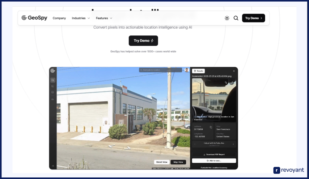
Developed by Graylark Technologies, GeoSpy AI is designed for a diverse range of users, including journalists, investigators, researchers, and enthusiasts. Its applications span from verifying the authenticity of images to aiding in open-source intelligence (OSINT) investigations.
GeoSpy AI can pinpoint locations just by analyzing a single photograph.
How GeoSpy AI Identifies Image Locations Without Metadata
GeoSpy AI isn’t just making educated guesses. It’s running each image through a carefully designed sequence of AI-powered steps—each one focused on pulling clues from the visuals alone.
🔍 Visual Feature Extraction
Scans visible elements like buildings, terrain, and signs to identify key visual markers and reduce location possibilities.
🧠 Pattern Recognition
Compares features against a large database of geotagged images to find visual matches tied to real-world locations.
🌦️ Contextual Clue Matching
Analyzes environment-specific cues—like sun angle, climate, and vegetation—for deeper geographic inference.
📍 Location & Confidence Score
Delivers a predicted location with coordinates and a confidence score, helping users judge result reliability.
Here’s a deeper look at how it does that:
Step 1: Visual Feature Extraction — Buildings, Terrain, Signs, and More
When you upload an image, GeoSpy AI begins by scanning every visible element in the photo. This includes:
- The shape and design of buildings
- The type of vegetation or natural terrain
- Language or symbols on signs
- Road markings, architectural styles, and even street furniture
These features form the foundation of how the system begins to narrow down possibilities. It’s almost like how a human might guess a city by noticing palm trees or European-style windows—except GeoSpy does it on a much broader scale and in seconds.
Step 2: Pattern Recognition Using a Global Image Dataset
Once the photo has been analyzed, the system compares those extracted features to millions of known, geotagged images stored in its training dataset. This dataset includes images from around the world, categorized by location.
GeoSpy uses deep learning to recognize visual patterns that are unique to certain places—like a type of brick that’s mostly used in a specific region, or a skyline that matches photos from a known city. This step helps it eliminate areas that don’t match and focus in on a few potential zones.
Step 3: Contextual Clues—Weather, Sun Angle, and Vegetation
After identifying structural and visual similarities, GeoSpy moves on to interpreting context—something often missed by simpler systems.
It looks at things like:
- Weather conditions visible in the image (fog, snow, lighting)
- The angle of the sun to estimate the hemisphere and the time of day
- Vegetation type and growth (useful for climate zone matching)
These additional clues are used to strengthen or rule out potential locations, especially when the visual architecture isn’t distinct enough on its own.
Final Step: Location Prediction with Confidence Score
After gathering and processing all visual and environmental details, GeoSpy calculates the most likely location for the photo. It returns a result in the form of:
- A location pin (often on a map)
- Coordinates (latitude and longitude)
- A confidence percentage that indicates how sure the system is
If the confidence score is high, the tool will find a strong alignment between the uploaded image and several elements within one specific region. If the score is lower, it’s flagging that the location is a possible match but with less certainty.
This layered approach is what makes GeoSpy AI particularly effective, even when metadata (like GPS tags) has been removed or was never included to begin with. It relies purely on what the human eye can see and what the AI can interpret at scale.
GeoSpy AI Features: What Makes It a Powerful Geolocation Tool
GeoSpy AI brings together the power of computer vision, pattern analysis, and geolocation into a seamless image recognition platform. Whether you’re using it for research, verification, or curiosity, here’s a closer look at what makes it stand out:
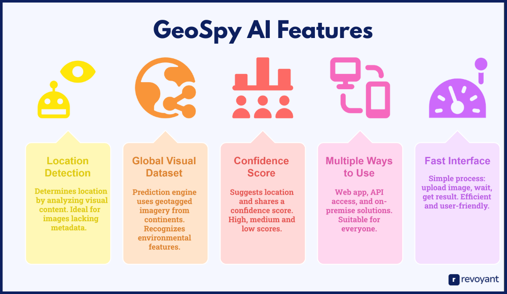
Detect Photo Locations Without Relying on GPS or EXIF Metadata
Most tools depend on GPS data embedded in images, but GeoSpy AI takes a different path. It doesn’t need hidden file information like EXIF tags to function. Instead, it studies the photo’s visible content—rooftops, landscapes, signboards, and surroundings—to figure out where it might have been taken.
This makes it ideal for images where metadata has been removed, altered, or was never available (e.g., screenshots, re-shared posts, compressed social media graphics).
Built on a Massive Global Dataset for Visual Accuracy
GeoSpy AI’s prediction engine is built on top of a rich library of geotagged imagery collected from across continents. This gives it the visual “memory” needed to recognize unique environmental features—like a bridge in Paris or a coastline in Bali—and tie them back to real-world places.
Whether the image is from a major city or a small rural area, the tool can still pick up distinct visual markers and offer smart guesses.
Get Location Results With Transparency and Confidence Scoring
Each time you upload photos, GeoSpy AI not only suggests a location, it also shares a confidence score. This tells you how closely the photo aligns with what the AI has seen during its training.
- High score = strong visual match to known data
- Medium score = likely, but with some uncertainty
- Lower score = possible matches, but fewer similarities
This feature is particularly helpful for investigators or analysts who need a level of certainty before taking action.
Web, API & On-Prem: How You Can Access GeoSpy AI
GeoSpy AI isn’t limited to a web-based interface. Developers and teams can integrate it directly into their systems via API access. For enterprises and government teams with privacy requirements, it also offers on-premise solutions that keep data fully secure and in-house.
This flexibility makes it suitable for everyone, from casual users to large-scale operations.
Easy to Use: Upload and Discover in Seconds
You don’t need to be a tech expert to use GeoSpy. The process is simple: upload your image, wait a few seconds, and get a result. There’s no need to set up complex workflows or interpret raw data. It’s built to be efficient and user-friendly—even for someone using it for the first time.
Who Uses GeoSpy AI? Top User Types and Their Use Cases
GeoSpy AI isn’t just built for one type of user—it supports a wide range of professionals and enthusiasts who rely on image verification, location tracking, or context discovery.
| User Type | Why They Use It | Use Case Example |
|---|---|---|
| Journalists & Fact-Checkers | To verify image origins and provide accurate context when reporting global events or investigating viral media. | A news outlet verifies the location of a protest photo before publishing it to ensure accuracy. |
| Investigators & Law Enforcement | To identify locations from image evidence during criminal investigations, cybercrime tracking, or trafficking cases. | Authorities analyze a suspicious image to narrow down its region and assist in ongoing investigations. |
| OSINT Analysts | To support intelligence and defense operations by geolocating images from open-source or surveillance content. | An analyst uploads drone footage to GeoSpy to determine the location of an environmental incident. |
| Educators & Researchers | To teach students about AI, geography, and visual data ethics using real-world visual recognition tools. | A professor uses GeoSpy in a classroom to help students understand how AI interprets geographic data. |
| Travelers & Content Creators | To identify unknown locations from older travel photos or online visuals lacking location tags. | A travel blogger uploads a scenic image to GeoSpy to find and feature the destination in a blog post. |
Here’s who finds it especially valuable:
Journalists & Fact-Checkers: Verifying Images for News Accuracy
Why do they use it?
When covering global events or verifying viral photos, journalists often come across images with no clear source or location. GeoSpy AI helps them determine where a photo was likely taken—adding context to a story or confirming authenticity before publication.
Use Case Example:
A news outlet receives a protest photo claimed to be from a specific region. Before publishing, they run it through GeoSpy to verify if it aligns with that location or possibly originated elsewhere.
Law Enforcement: Locating Image Origins in Investigations
Why do they use it?
For professionals involved in criminal investigations, human trafficking, or cybercrime, identifying where a photo was taken can lead to real breakthroughs. GeoSpy AI becomes a valuable part of the digital forensics toolkit.
Use Case Example:
Authorities trying to track the origin of a suspicious online image use the tool to narrow down regions and cross-reference it with local intelligence.
OSINT Analysts: Enhancing Intelligence With Visual Clue Matching
Why do they use it?
In intelligence and defense work, visual clues in images are often the key to mapping timelines or locations. OSINT professionals use GeoSpy to accelerate geolocation workflows, especially when working with crowdsourced data or surveillance imagery.
Use Case Example:
An analyst investigating an environmental incident uploads drone footage screenshots to GeoSpy AI to triangulate its location and match it with recent reports.
Educators & Researchers: Teaching With Real-World Visual AI
Why do they use it?
Teachers and researchers use GeoSpy to demonstrate AI applications in geography, environmental science, and data ethics. It can turn lessons into interactive visual learning experiences.
Use Case Example:
A university professor includes GeoSpy in a classroom project where students explore how machine learning interprets global environments.
Creators & Travelers: Identify Photo Locations for Content and Curiosity
Why do they use it?
Sometimes people simply want to figure out where a photo was taken—maybe it’s an old vacation picture or a beautiful scene posted online. GeoSpy makes it easy to turn curiosity into answers.
Use Case Example:
A travel blogger finds a striking landscape photo with no location tag. They use GeoSpy to identify the region and include it in their next travel list.
Why Use GeoSpy AI? Real-World Benefits and Competitive Edge
GeoSpy AI stands out not just because it’s accurate, but because it offers meaningful utility across different user types.
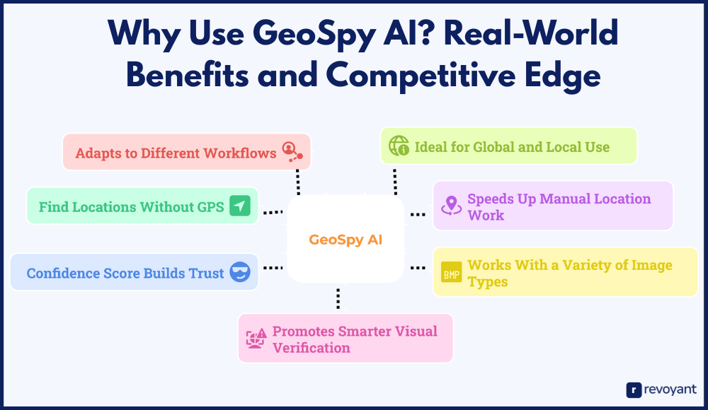
Below are the core benefits, expanded with real-world relevance:
No Metadata? No Problem—GeoSpy Can Still Find the Location
Many modern tools depend on metadata to geolocate images. But what happens when that data is stripped, or never existed in the first place?
GeoSpy AI fills that gap. Instead of reading hidden GPS data, it examines what’s in the image itself: buildings, trees, mountains, weather patterns, and signage.
This makes it incredibly useful for:
- Screenshots from social media
- Cropped or edited photos
- Images downloaded from the web
- Old photos that were taken before smartphones embedded GPS
You don’t need anything extra—the photo alone is enough for GeoSpy AI to begin its analysis.
Save Hours: GeoSpy Automates the Location-Guessing Process
If you’ve ever tried to trace the location of a photo manually, you know it can be a slow, frustrating process. You’ll often:
- Zoom in on blurry signs
- Match Google Maps views to terrain
- Search image snippets online
GeoSpy AI handles all of that instantly. Just upload the image, and it does the heavy lifting—analyzing thousands of possibilities and offering the closest matches in seconds. Whether you’re a journalist with a tight deadline or an analyst scanning dozens of images, this speed matters.
Cropped, Blurry, or Compressed? GeoSpy Still Works
You don’t need a perfect photo. GeoSpy AI is designed to work with:
- Cropped or low-resolution images
- Compressed screenshots from messaging apps
- Drone footage stills or security footage frames
- Travel images taken in remote areas
It’s built with flexibility in mind, helping users get answers from photos that may not look ideal to the human eye, but still contain enough signals for AI to analyze.
Transparent Results: Understand Confidence Scores Easily
One of the best parts about GeoSpy AI is that it doesn’t just throw a random location at you—it shows how confident it is in that guess. For example:
- A 90% confidence score suggests a strong visual match
- A 60% score signals a possible location, but with less certainty
This is important in scenarios where accuracy matters, like publishing a news article or submitting a location for a case study. The confidence score acts as an extra layer of transparency.
Integrates With Web, API, and Enterprise Workflows
GeoSpy AI isn’t locked into a single format. You can use it:
- As a web app for personal use
- Via API to plug into your own tools or systems
- In an on-premise setup for private or secure environments
This makes it useful for individuals, teams, and even government or enterprise users who want control over where and how their data is processed.
Works on Photos From Cities, Villages, or Remote Locations
Whether you’re working with an image from a remote mountain village or a major city skyline, GeoSpy AI is built to process it. Its training data includes a wide mix of geographical visuals, so it can handle international photos just as well as local ones.
It’s useful for:
- Exploring travel photos
- Analyzing environmental damage from satellite images
- Tracking locations in international news
- Mapping undocumented visual content
Combating Misinformation With Smart AI Image Analysis
In a time where misinformation can spread rapidly through visuals, tools like GeoSpy AI help people verify what they’re seeing. It encourages smarter internet behavior by showing that images can be traced—even when they appear context-free.
Whether you’re a content creator, a researcher, or a curious learner, this tool gives you a better understanding of the digital content you come across every day.
Real-World GeoSpy AI Applications in News, Crime, Travel, and Education
GeoSpy AI isn’t just a tech demo—it’s a tool that people use to solve real problems, verify facts, and explore visual data with a purpose.
🗞️ Verifying News Images
GeoSpy AI helps editors confirm if viral images are real and from the claimed location—avoiding misinformation.
🕵️ Online Investigations (OSINT)
Investigators use GeoSpy to match city skylines and validate visual clues in cybercrime or surveillance images.
📸 Rediscovering Travel Photos
Travel creators identify places from old photos using GeoSpy’s suggestions—great for labeling, planning, and storytelling.
👩🏫 AI in the Classroom
Educators use GeoSpy for hands-on lessons in machine learning and visual pattern analysis—making AI more accessible.
📽️ Archival Footage Insights
Researchers analyzing historical media use GeoSpy to detect unknown locations, enriching digital archives and history projects.
🚨 Crisis & Law Enforcement
GeoSpy assists in identifying unknown areas in critical images—supporting missing person cases and regional search efforts.
Below are practical examples that show how it’s being applied in different fields:
Use Case: Verifying Viral Images in Breaking News
Use Case:
A news editor receives a viral image from social media, claiming to show a protest in a specific country. But with no metadata or location tags, it’s unclear whether it’s genuine or even current.
How GeoSpy Helps:
The photo is uploaded to GeoSpy AI, which quickly analyzes its background and layout. Within seconds, it provides a possible match, placing the image in a different country altogether. This prevents the outlet from publishing misleading content.
Use Case: Using GeoSpy for OSINT and Digital Intelligence
Use Case:
An online investigator working on open-source intelligence is reviewing images related to a cybercrime group. One image contains a city skyline, but no clear indicators of where it was taken.
How GeoSpy Helps:
By using GeoSpy AI, the investigator receives a likely city and cross-checks that with other digital footprints. This helps validate the location, guiding further steps in the investigation.
Use Case: Find Where That Travel Photo Was Taken
Use Case:
A travel blogger has a backlog of photo content but forgot where some of the images were taken. With no tags or records, those shots are hard to reuse.
How GeoSpy Helps:
They upload the images to GeoSpy AI and get suggested coordinates for each one. With this data, they can now label photos correctly, plan blog content, and even revisit the places.
Use Case: AI & Image Location Learning for Students
Use Case:
An educator teaching a course on artificial intelligence wants students to explore how machines interpret visual data.
How GeoSpy Helps:
GeoSpy becomes a hands-on activity. Students upload photos, analyze the AI’s predictions, and discuss how machine learning models identify patterns. It turns theory into something practical and engaging.
Use Case: Finding Hidden Locations in Old Footage and Photos
Use Case:
A historical researcher is digitizing old family photos and film reels. Some shots have unclear locations and dates, making it hard to contextualize them.
How GeoSpy Helps:
By uploading those visuals to GeoSpy, they get location suggestions that help narrow down the region or city. This leads to more accurate archiving and better storytelling.
Use Case: GeoSpy AI in Search, Rescue & Investigations
Use Case:
A missing person investigation includes a social media photo that might contain clues about the last known location, but the background is unfamiliar.
How GeoSpy Helps:
GeoSpy AI analyzes the image and points investigators toward a specific region. This insight can help redirect search efforts or verify witness claims.
These examples show that GeoSpy AI goes far beyond entertainment or curiosity. It plays a role in serious decision-making, digital storytelling, education, and public safety.
GeoSpy AI Pricing & Access: Demo, API, and Enterprise Options
GeoSpy AI offers flexible access based on how you want to use the tool—whether it’s for individual exploration, team use, or integration into your workflow. While the website doesn’t publish fixed pricing publicly, here’s what we know about its structure and availability:
| Access Type | Details | Best For |
|---|---|---|
| Free Demo (Limited Access) | Upload a sample image and test the system in real time with basic access. | Casual users, educators, bloggers |
| Commercial Licensing (Custom Pricing) | Includes full platform access, priority processing, and high-volume support. Pricing based on usage needs. | Newsrooms, OSINT teams, law enforcement, analysts |
| API Access for Developers | Integrate GeoSpy into your own tools. Offers monthly credits, dev support, and flexible scaling. | SaaS platforms, internal tools, developers |
| On-Premise Deployment | Offline, fully controlled version for secure environments. Includes installation and compliance support. | Government, defense, data-sensitive organizations |
Free Demo (Limited Access)
For users who want to test the tool before committing, GeoSpy AI provides a limited trial/demo. This lets you upload a sample image and see how the location detection system works in real time.
Ideal for: Casual users, educators, or bloggers exploring the tool’s potential.
Commercial Licensing (Custom Pricing)
For professional or enterprise-grade usage, GeoSpy AI offers licensing options that include access to the full platform. This may include:
- Higher upload limits
- Priority processing
- Advanced reporting
- Support for larger image batches
Pricing for these plans is customized based on usage volume and whether you need API or on-premise deployment.
Ideal for: Newsrooms, OSINT teams, law enforcement units, analytics firms
API Access for Developers
GeoSpy AI also supports API integration. This allows developers to embed the location-identification capability into their own platforms, dashboards, or custom software.
- Ideal for workflow automation or internal tools
- Typically involves monthly credits or volume-based pricing
- Comes with documentation and developer support
Ideal for: SaaS companies, data analysts, and tool builders
On-Premise Deployment
For users who handle sensitive data and require full control, GeoSpy AI offers an on-premise version. This setup ensures:
- Local processing (no cloud dependency)
- High data privacy and regulatory compliance
- Tailored support and installation
Ideal for: Government agencies, defense organizations, or high-security environments
To receive a personalized quote or explore the right access plan for your needs, GeoSpy AI recommends submitting a contact form on their official website. A team member will follow up based on your usage type and scale.
Ethical Use of GeoSpy AI: Privacy, Consent, and Responsibility
GeoSpy AI is an impressive tool with powerful capabilities, but with that power comes responsibility. Just like any form of advanced technology, how it’s used matters as much as what it can do. While the tool itself is neutral, its impact depends entirely on user behavior and intent.
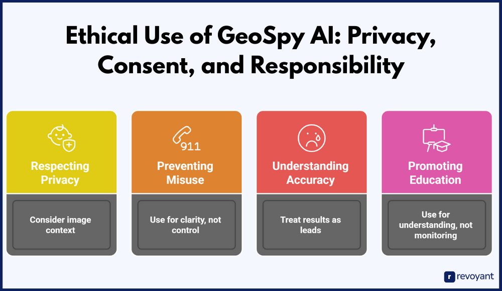
Here are several key ethical considerations to keep in mind when using GeoSpy AI:
Respecting User Privacy When Analyzing Public Photos
GeoSpy AI doesn’t require metadata to guess where a photo was taken—it relies entirely on visual analysis. That strength, however, means it can also be used to examine photos that were never meant to be geolocated. If someone shares a personal image online—whether in a group chat, blog post, or social media update—there’s an expectation of context.
Using AI to trace the location of such content, especially without permission, can feel invasive. Users should always consider whether the image was intended for public consumption and avoid using the tool to analyze private or sensitive content without a clear and respectful purpose.
Don’t Use GeoSpy to Spread Misinformation or Harass Others
Like many AI tools, GeoSpy AI can be used to validate information—but it can also be misused to spread or reinforce false narratives. In the right hands, it can verify if a photo actually shows what it claims. In the wrong hands, it could be weaponized to mislead, manipulate, or harass others.
For example, someone might attempt to track down a person based on their photos, or falsely claim GeoSpy “proved” an image’s origin without proper verification. That’s why it’s important to use the tool as a means of clarity, not control.
AI Isn’t Always Right: Why You Should Cross-Check Results
GeoSpy AI does not provide absolute certainty. It offers predictions based on visual cues and pattern matching, which are often highly accurate, but not infallible. Environmental changes, photo quality, seasonal differences, or architectural similarities across countries can lead to incorrect suggestions.
For critical decisions, especially those tied to journalism, investigations, or policy, the results should be treated as leads—not conclusions. Always verify with secondary sources or expert input before drawing final judgments from AI-generated predictions.
Empowering Learning, Not Surveillance
One of the best applications of GeoSpy AI is in education, training, and transparent research. It’s a useful tool to teach students how machine learning interprets the world, or to explore how digital content can be analyzed for truth and context. But when used for surveillance, digital stalking, or monitoring people without their knowledge, the same tool becomes problematic.
GeoSpy AI is not designed for covert tracking or personal monitoring. Its strength lies in helping people understand visual content more clearly, not in violating boundaries.
GeoSpy AI represents a leap forward in how we interpret images. It can support fact-checking, enhance education, and assist with responsible investigations. But like any technology, it must be used ethically. Being mindful of privacy, accuracy, and intent will ensure that this powerful tool contributes to transparency and learning, rather than overreach or harm.
Final Thoughts: Is GeoSpy AI the Right Tool for You?
GeoSpy AI offers a rare mix of curiosity, utility, and innovation. It allows anyone—from content reviewers to digital investigators—to uncover the geographic story behind an image, even when traditional data is missing. Whether you’re working with screenshots, social media posts, or historical photos, GeoSpy gives you the ability to draw insights from visual clues alone.
Its biggest strengths lie in how easy it is to use, how flexible the access options are, and how effectively it bridges the gap between visual analysis and real-world geography. From solo users to enterprise teams, the tool fits into many workflows with ease.
At the same time, using GeoSpy AI comes with responsibility. While it’s built for exploration, education, and verification, it should always be used with care—especially when dealing with personal or sensitive content.
If you’re looking for an image-location tool that doesn’t rely on metadata and offers surprisingly accurate predictions powered by AI, GeoSpy AI is well worth a closer look. It’s a practical choice for those who want more than just a reverse image search—it’s a smart assistant that helps you understand where a picture fits in the real world.
GeoSpy AI FAQ: Common Questions and Clear Answers
Can GeoSpy AI identify any image location without GPS data?
Yes, GeoSpy AI is designed to work even when image metadata (like GPS or EXIF tags) is missing. It analyzes visible elements in the photo, such as landscapes, buildings, or signs, to estimate the location.
How accurate is GeoSpy AI’s location prediction?
GeoSpy AI provides a location estimate along with a confidence score. While the tool is often very accurate, especially with clear outdoor images, it’s important to treat the results as predictions, not absolute confirmations.
Is GeoSpy AI suitable for professional investigations or journalism?
Yes. Many investigative teams, journalists, and OSINT researchers use GeoSpy AI for fact-checking and verifying image origins. Its ability to function without metadata makes it especially useful in cases where image sources are unclear.
Can I integrate GeoSpy AI into my own platform or workflow?
Yes, GeoSpy AI offers API access and on-premise deployment options. These are designed for developers, enterprise teams, or organizations that want to embed geolocation capabilities into custom tools or secure environments.
Is there a free version or trial of GeoSpy AI available?
GeoSpy AI offers a limited demo for users to test its capabilities. For full access and commercial use, pricing is offered on a custom basis depending on your needs and usage volume.


